Lake Somerville Update 02-04-2012 with pics!

shimp

New member
Lake is rising fast, lots of rain North and North West (in the primary drainage basin for Nells Creek and Yegua Creek, the main arteries that feed water into Somerville) last night, VERY heavy rainfall.


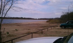
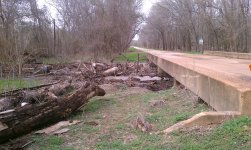
Pics start at Pecan Lake Park, and we drive around the county roads up Flag Pond Ln and back around Birch Creek back up to Welch Park.  Pics in sequence as we drove.


shimp

New member
Big puddles of standing water are a very common sight around the upper end of the lake, this was on the backroad that goes behind Nells Creek Park and Flagpond.  Second 2 pics are Nells Creek, which feeds into the lake on the very upper end (which was completely dried up).
 

shimp

New member
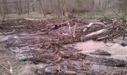
Nells Creek, full as can get, lots of debris piling up against this bridge, hopefully keeping it out of the lake, and just letting the water in...
 

Attachments

  • Somerville-02-04-2012-10.jpg
    Somerville-02-04-2012-10.jpg
    650.5 KB · Views: 67

shimp

New member
The biggest creek feeding into the lake exclusively, Yegua Creek.  This thing was running with a vengeance.....
 

shimp

New member
The boat ramp at Birch Creek Forest (subdivision members only), and followed by pics of boat ramp at Welch Park.
 

shimp

New member
Current Lake Level is reported (today at some time today) -8.15 feet below Convervation Pool Level (full at 238.00 feet above mean sea level, currently 229.85).

Given that this rain was more than the last rain and hung around longer in that area (the drainage basin of Nells Creek and Yegua Creek) AND the ground was already fully saturated from the last rains, this water has nowhere else to go, but into the lake....  Just an uneducated guess, but I would expect it to rise 2-4 feet in the next week/two. 

More rain in the forecast this coming week!
 

shimp

New member
At 08/21/2011 Welchfest, the lake level was at -8.34, so it is already above that level and the water has only begun to flow in from last nights heavy rains, so I'd expect it to come up a whole lot more really quick, especially if it rains heavy again in the next couple days. 

Level around the time we all met up there in July, was -4.7 feet, and it was pretty nice at that point, only 3.45 feet from 07/09/2011 Levels as of Today, again with all the water from last nights heavy rains just now running into the Lake.

So it's looking good.  I really hope it fills back up so we can all go play at Somerville.
 

shimp

New member
As of this morning, the lake is -7.48 feet, only 2.78 feet from 07/09/2011 level.  Steady rising!
 

shimp

New member
Here is a Hazards map for Somerville, using the latest Google Earth imagery which lets you actually see the hazards that are normally under the water a foot or two....  Lots of people with propeller boats mess their props up on this stuff because they have no idea it's there till it's too late.  Most of this stuff noted on the map won't give the jet guys any trouble at all unless the lake is pretty low you may suck up a little mud/sand, but that's it in most cases with the jets.  After is a pic of the lake from Google Earth WITH water in it so you can see what all is covered up normally.


scarabscs

New member
Awesome info Chris.  Its great to hear the levels are coming back up.  I guess once we get back to Jun levels from last year, its deep enough for me to run my rig back to Pecan!  :smile16:
 

77Jet Star

Active member
Patchman said:
Great info and pics! Oh and thanks for the map! clap.gif :smile16:
You would have to get your boat out of the shed and go to the lake for that map to do you any good Patch  crazy.gif                      Mod please feel free to move this to Patch's hate mail thread.  :smile30:
 

Patchman

Administrator
Staff member
JETSTAR said:
Patchman said:
Great info and pics! Oh and thanks for the map! clap.gif :smile16:
You would have to get your boat out of the shed and go to the lake for that map to do you any good Patch  crazy.gif                      Mod please feel free to move this to Patch's hate mail thread.  :smile30:
Why would I want to do that, when I can just ride with you for free! :smile16: think.gif
 

77Jet Star

Active member
Patchman said:
JETSTAR said:
Patchman said:
Great info and pics! Oh and thanks for the map! clap.gif :smile16:
You would have to get your boat out of the shed and go to the lake for that map to do you any good Patch  crazy.gif                      Mod please feel free to move this to Patch's hate mail thread.  :smile30:
Why would I want to do that, when I can just ride with you for free! :smile16: think.gif
Touche' you have a point  :smile20:
 
Top